National Park Service writes new plan to improve access to Bay watershed
Public comment period for draft plan will remain open through late August.
Update (August 21, 2012): The public review and comment period for the draft Chesapeake Bay Watershed Public Access Plan has been extended until September 14, 2012. Comments can be submitted via email or an online mapping tool.
The Chesapeake Bay and its rivers and streams remain just out of reach for many watershed residents. Physical barriers and unsafe conditions, a lack of awareness as to what might be nearby or an absence of available access sites can pose problems for those who want to explore the Bay and its tributaries.
A new draft plan published this week by the National Park Service (NPS) strives to improve public access to local and regional waters, forests, and open lands.
The draft Chesapeake Bay Watershed Public Access Plan, developed by a team of NPS staff and public access planning professionals from across the Bay Program partnership, acts as a roadmap that offers new avenues for the public to connect with the Bay.
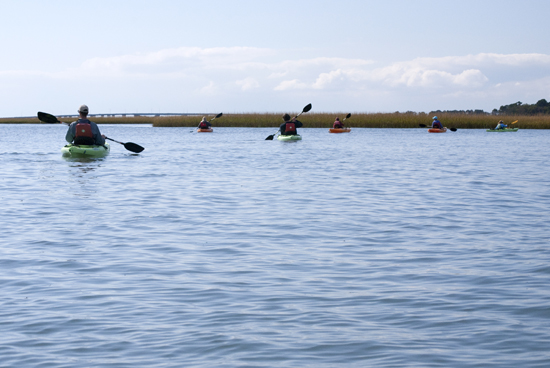
As public access to the Bay expands, residents and visitors will find more opportunities to boat and swim; to fish, observe wildlife, and walk trails; and to reconnect with the watershed. Building personal connections with the places that have shaped life in the Bay region can benefit public health, regional tourism economies and watershed conservation and stewardship efforts.
A product of the Strategy for Protecting and Restoring the Chesapeake Bay Watershed, which in May 2010 called for the addition of 300 new public access sites in the region by 2025, the draft plan identifies current and potential access sites and outlines the planning and policy considerations that must be taken into account before new sites are created. The plan will serve as a guide to federal, state, and local governments, as well as non-profit organizations, in prioritizing and allocating funding for the development of access sites throughout the watershed.
Currently, there are just over 1,100 existing public access sites within the Bay watershed. While this number has steadily increased over the past decade, it remains low for a watershed that spans 64,000 square miles. Often, these sites are miles apart--and less than half of existing access sites provide visitors with the facilities needed to put boats, canoes, or kayaks into the water.
Public demand for improved access to the Bay greatly informed the formation of the draft plan, generating in the last year more than 400 suggestions for specific public access points. Hoping to continue its collaboration with the public, the NPS encourages citizens to submit comments on this draft plan via email or its online mapping tool by August 24.
Learn more about the draft Chesapeake Bay Watershed Public Access Plan at the Chesapeake Bay Gateways Network website.
Comments
There are no comments.
Thank you!
Your comment has been received. Before it can be published, the comment will be reviewed by our team to ensure it adheres with our rules of engagement.
Back to recent stories