How one town is determined not to drown
Collaboration and local engagement aim to restore an Eastern Shore community
I’m staring out the window of a beat-up U.S. Fish and Wildlife Service pick-up truck, watching the sun glisten off of Pocomoke Sound, while trying very hard not to be anxious at the sight of water lapping over parts of the road that my colleagues and I are cruising down.
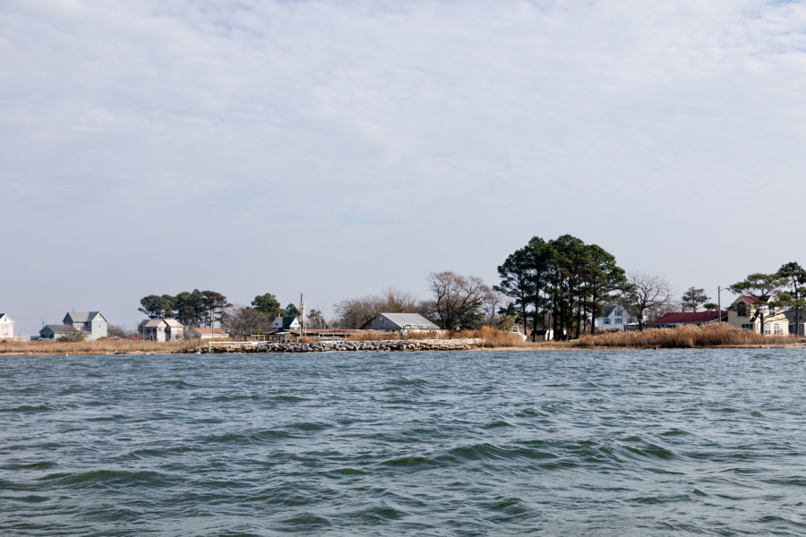
We are headed to Saxis, a very small town that lies on Virginia’s Eastern Shore. It is the town you head to if you are looking for peace and quiet, the opportunity to get out on the water and eat some delicious, freshly-caught seafood. In 2021, the town’s population was about 252 residents, most of whom rely on the water for their livelihoods.
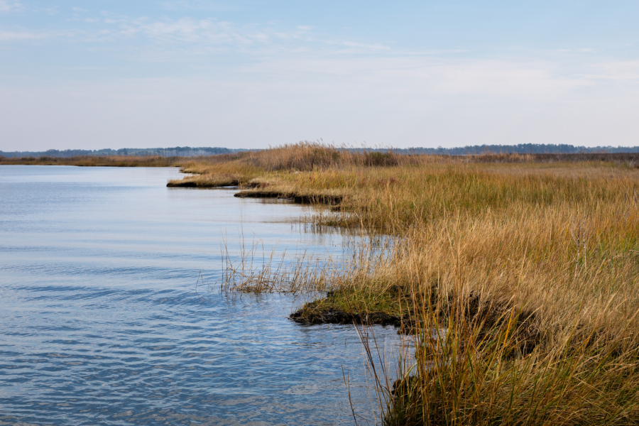
Despite the beautiful day, the landscape shows an unsettlingly clear reminder of the impacts of climate change. Besides the encroaching water on Route 695, the road is starkly lined with ghost forests as it bisects the Saxis Wildlife Management Area. High tides and heavy storms regularly wash out Route 695, turning Saxis into a temporary island. Sea level rise has threatened the town for decades, but Hurricane Sandy in 2012 almost decimated the close-knit community.
According to the EPA’s Climate Justice and Economic Screening Tool, Saxis is considered to be a Climate Justice Community. It is deemed so because of its high projected flooding risk and expected rate of building loss, but also due to its low-income status. The median income of Saxis is $35,417, not far above the poverty line in Virginia. In the Accomack-Northampton Planning District Commission’s Eastern Shore of Virginia’s Hazardous Management Plan, it is noted that Saxis loses approximately 4.9 feet of shoreline per year.
But the residents are far from giving up on their town—which is why I found myself among a group of people from the Environmental Protection Agency (EPA), Chesapeake Bay Trust, The Nature Conservancy, Maryland Department of Natural Resources, Virginia Institute of Marine Science and U.S. Fish and Wildlife Service descending upon Saxis today. Thanks to recent investments from the Bipartisan Infrastructure Law, a large-scale Climate Adaptation Initiative is in the works for Pocomoke Sound—a portion of the Chesapeake Bay that encompasses Saxis. Members of the group are interested in learning how the initiative will address climate impacts and what it means for the residents of Saxis.
Building on decades of restoration in Pocomoke Sound
Efforts to understand rising sea levels and flooding in the region go back to the 1970s when the U.S. Army Corps of Engineers conducted a tidal study in the lower Chesapeake. When Hurricane Sandy hit, however, folks really began to sit up and take notice.
Mayor Denise Drewer noted in a 2020 Bay Journal article, “Sandy hit us hard and it was very devastating. I wouldn’t wish that on anyone, but a lot of good has come out of it.”
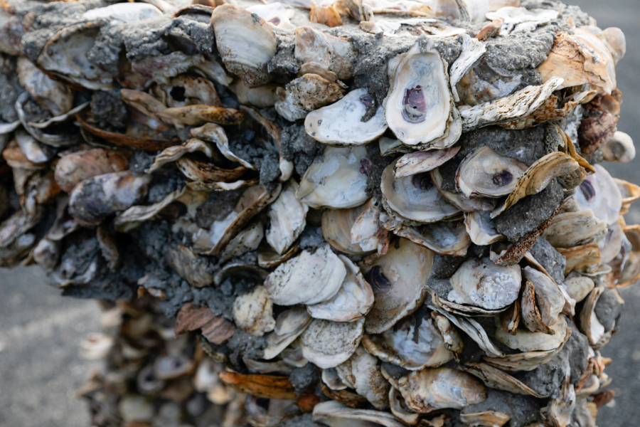
Federal funding from the hurricane allowed the harbor in Saxis to be re-dredged where sand and sediment had built up, keeping watermen from accessing the Bay. It also paid for a disposal area to be built to store the dredged material and the U.S. Army Corps of Engineers installed a rock jetty to protect the dredge site. Other funding opportunities since have allowed for artificial reefs of concrete and oyster shells to be built off the town pier, trees to be planted and a 322-foot jetty to be installed.
When the Bipartisan Infrastructure Law was passed in November 2021, it brought a staggering amount of funding to EPA’s Chesapeake Bay Program–$238 million, in fact. Working with the Chesapeake Bay Trust–a nonprofit grant-making organization–to administer a wetlands capacity-building grant, funding was awarded to The Nature Conservancy in 2023 to build upon the work already done in the region and create the large-scale Pocomoke Sound Climate Adaptation Initiative.
Dreaming of climate mitigation projects
When we pull up to the town pier, Mayor Drewer is there herself, waiting to welcome us with shucked oysters and clam chowder that she woke up early to make. We are headed out on boats to take in the landscape surrounding Pocomoke Sound, where a number of restoration projects are being proposed.
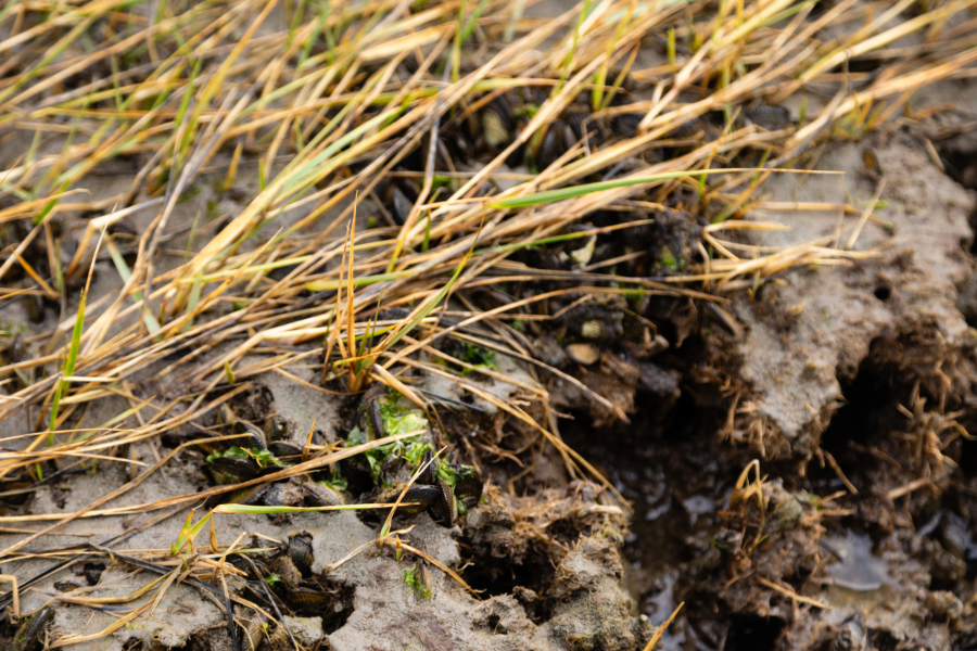
According to The Nature Conservancy, the first order of business underneath the Pocomoke Sound Climate Adaptation Initiative is to create a landscape-scale restoration strategy. This strategy will contain recommendations for projects that will help mitigate and adapt to climate change impacts in and around the town of Saxis. The majority of the proposed projects will address efforts to protect and restore the tidal marshes and wetlands that surround Saxis. Wetlands protect against rising sea levels by absorbing high tides and soaking up stormwater. They also provide habitat for hundreds of species of plants and animals. However, development, invasive species and saltwater intrusion all contribute to wetland loss on Virginia’s Eastern Shore, which only exacerbates flooding caused by sea level rise.
The experts on the boat tour note that some of the projects they are recommending to bolster wetlands include using dredge material from the Saxis harbor to restore and elevate existing marshes, installing native wetland plants and allowing sand in marsh sills, breakwaters and other structures to build up naturally in the tidal marshes.
As our boat motors close to the shoreline, allowing us to peer at some existing wetlands, Pam Mason, co-chair of the Bay Program’s Wetlands Workgroup and senior research scientist with the Virginia Institute of Marine Science tells us that “the largest increase in ecotourism in Virginia is the Eastern Shore.” These enhancements to Saxis’ landscape will not only protect the town from environmental impacts, but also provide the foundation to increase the town’s tourism base, positively contributing to the community and economy.
Visitors to the nearby Saxis Wildlife Management Area can participate in hunting, trapping and camping, as well as access the water by several boat ramps. But most notably, the region offers birders the opportunity to see a wide variety of geese, ducks and other bird species, which will only stand to increase as environmental improvements are made across the region. Mason also notes that 80% of salt marsh sparrows and Nelson’s sparrows overwinter along the Eastern Shore. The proposed projects are anticipated to help increase the populations for both of these species of sparrows, along with black rails and black ducks, specifically.
Other projects being recommended include underwater grass plantings, which will help restore fish and blue crab habitat and keep the waters healthy, install additional substrate to build up existing oyster reefs and the creation of riparian buffers to help forest wetlands and keep waters cool and fresh.
Putting community first
The Nature Conservancy has been working on the Eastern Shore of Virginia for 53 years. Their work began along the ocean side of the shore, and then spread across the border to Crisfield, Maryland in 2022, where collaboration to combat climate change impacts is actively in process.
The Nature Conservancy’s success on the Eastern Shore is largely attributed to their collaborative model of directly working with local residents, understanding their priorities and needs and helping to connect them with outside partners to secure funding and build capacity.
Now it’s time to fill in the gap between these two areas–which is where you can find Saxis.
“[Our previous] landscape scale programs have involved the community,” said Jill Bieri, director of The Nature Conservancy’s Virginia Coast Reserve. “We are really excited to take that success and what we’ve learned, with everything, from all the partners, from all the communities that are working and do a landscape scale project on Chesapeake Bay.”
The Nature Conservancy’s first step toward developing the Climate Adaptation Initiative will be to plan and design a restoration strategy. For this, the organization will partner with the community. They will host listening sessions and elicit public feedback to help inform the strategy and prioritize what projects to focus on first.
Down the line, partnerships with federal and state agencies, other local nonprofits and universities will bolster collaboration, capacity and access to other funding sources. But most importantly, this will be an effort for and by the community.
“It’s about people as much as it’s about habitat,” remarked Mark Bryer, northeast U.S. division director for The Nature Conservancy.
It gets me thinking as I slowly walk back to the pick-up truck to head home. In my role, I am more often in meetings than out in the field. I am so grateful that I was able to get out of the office to be here in this special place. Too often, we fund projects, write stories and guide decisions without actually meeting the people, or visiting the place that will be impacted. I can't wait to come back to Saxis.
Comments
There are no comments.
Thank you!
Your comment has been received. Before it can be published, the comment will be reviewed by our team to ensure it adheres with our rules of engagement.
Back to recent stories