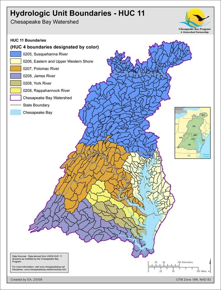
Hydrologic Unit Boundaries - HUC 11

- Author:
- Emma Andrews
- Date Created:
- February 5, 2008
The 11 digit Hydrologic Unit Code (HUC) coverage for the Chesapeake Bay watershed states level is an aggregate of the individual states clipped to the Chesapeake Bay Basin boundaries. These states are Delaware, Maryland, New York, Pennsylvania, Virginia, West Virginia, and Washington, D.C. This aggregate HUC-11 data set has been modified by the Chesapeake Bay Program GIS Team from USGS data to ensure edge matching and closed watersheds along state boundaries. There are a total of 506 HUC-11/watersheds for the Chesapeake Bay Basin in this aggregate data set.
