Maps
Browse through maps depicting Bay health and restoration, including pollution trends, public access sites and more.
Chesapeake Bay Waters Meeting WQ Goals for the Migratory, Spawning and Nursery Habitat Use 2010-2012
Date created: November 6, 2013This map demonstrates the attainment status of those Chesapeake Bay Program monitoring segments that have dissolved oxygen standards for the Migratory, Spawning and Nursery Habitat designated use during the 2010-2012 assessment period.
View mapChesapeake Bay Waters Meeting WQ Goals for the Migratory, Spawning and Nursery Habitat Use 2009-2011
Date created: September 12, 2013This map demonstrates the attainment status of those Chesapeake Bay Program monitoring segments that have dissolved oxygen standards for the Migratory, Spawning and Nursery Habitat designated use during the 2009-2011 assessment period.
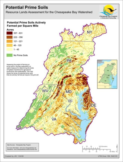
View mapPrime Farmland - Resource Lands Assessment
Date created: January 24, 2008Assessing the extent of farming on prime soils in the Bay watershed is a useful measure for determining the lands of highest importance for agricultural productivity and sustainability. This map shows the acres of potential prime soils that are actively farmed per square mile grid cell.
View map
