Maps
Browse through maps depicting Bay health and restoration, including pollution trends, public access sites and more.
Chesapeake Bay Waters Meeting WQ Goals for Open Water, Deep Water, and Deep Channel Uses 2010-2012
Date created: November 6, 2013This map demonstrates the attainment status of those Chesapeake Bay Program monitoring segments that have dissolved oxygen standards for the Open Water, Deep Water, and Deep Channel designated use during the 2010-2012 assessment period.
View mapChesapeake Bay Waters Meeting WQ Goals for the Migratory, Spawning and Nursery Habitat Use 2010-2012
Date created: November 6, 2013This map demonstrates the attainment status of those Chesapeake Bay Program monitoring segments that have dissolved oxygen standards for the Migratory, Spawning and Nursery Habitat designated use during the 2010-2012 assessment period.
View mapChesapeake Bay Waters Meeting WQ Goals for the Migratory, Spawning and Nursery Habitat Use 2009-2011
Date created: September 12, 2013This map demonstrates the attainment status of those Chesapeake Bay Program monitoring segments that have dissolved oxygen standards for the Migratory, Spawning and Nursery Habitat designated use during the 2009-2011 assessment period.
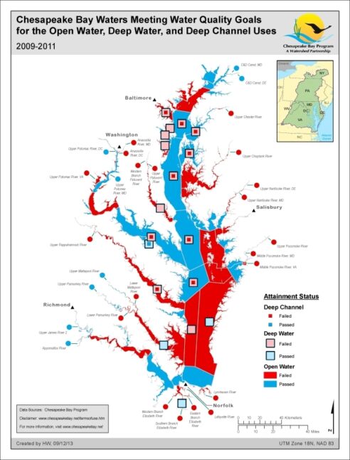
View mapChesapeake Bay Waters Meeting WQ Goals for Open Water, Deep Water, and Deep Channel Uses 2009-2011
Date created: September 12, 2013This map demonstrates the attainment status of those Chesapeake Bay Program monitoring segments that have dissolved oxygen standards for the Open Water, Deep Water, and Deep Channel designated use during the 2009-2011 assessment period.
View map
Dissolved Oxygen, Percent Goal Achieved for 2012, 3 YR Analysis
Date created: July 8, 2013The 2012 Dissolved Oxygen Indicator showing Percent of Goal Achieved using the three year analysis method.
View mapDissolved Oxygen, Percent Goal Achieved for 2011, 3 YR Analysis
Date created: May 10, 2012The 2011 Dissolved Oxygen Indicator showing Percent of Goal Achieved using the three year analysis method.
View mapDissolved Oxygen, Percent Goal Achieved for 2010, 3 YR Analysis
Date created: March 9, 2011The 2010 Dissolved Oxygen Indicator showing Percent of Goal Achieved using the three year analysis method.
View mapDissolved Oxygen, Percent Goal Achieved for 2009, 3 YR Analysis
Date created: March 5, 2010The 2009 Dissolved Oxygen Indicator showing Percent of Goal Achieved using the three year analysis method.
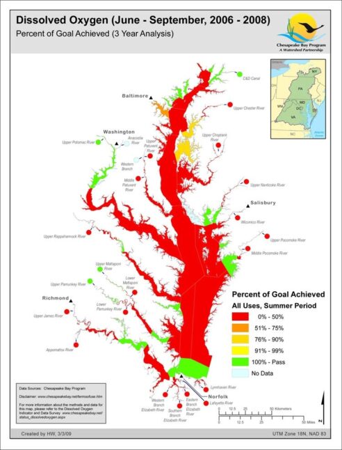
View mapDissolved Oxygen, Percent Goal Achieved for 2008, 3 YR Analysis
Date created: March 3, 2009The 2008 Dissolved Oxygen Indicator showing Percent of Goal Achieved using the three year analysis method.
View map
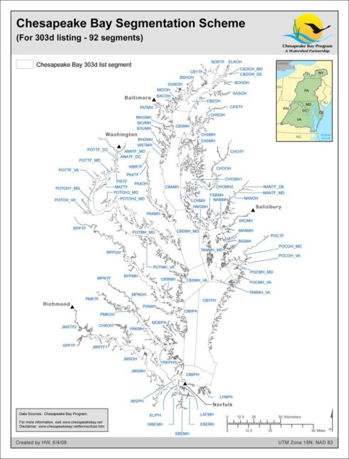
Chesapeake Bay Segmentation Scheme (For 303d listing - 92 segments)
Date created: June 4, 2008The 92-segment scheme for the Chesapeake Bay and its tidal tributaries used for dissolved oxygen and water clarity assessments in the most recent 303d/305b listing efforts of the four Bay tidal jurisdictions is documented here. The 92-segment scheme was derived from 1) the 2003 published 78-segment scheme with the addition of jurisdictional boundary lines imposed to create 89-segments, then 2) additionally includes only split segments agreed upon for the tidal James and Potomac rivers.
View map
