Maps
Browse through maps depicting Bay health and restoration, including pollution trends, public access sites and more.
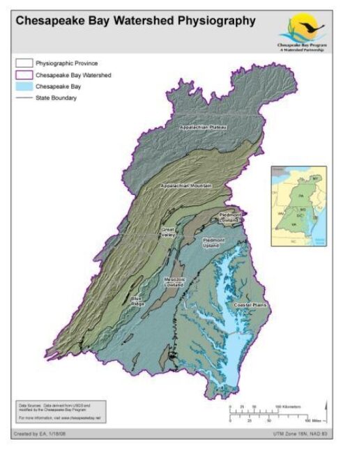
Chesapeake Bay Watershed Physiography
Date created: February 6, 2008Physiographic provinces in the Chesapeake Bay Watershed. Physiographic data derived from USGS and modified by the Chesapeake Bay Program GIS Team to divide the Piedmont into three distinct regions. Two out of the eight major US physiographic regions fall within the Chesapeake Bay Watershed; the Atlantic Plains and Appalachian Highlands. Within these regions, there are eight provinces within the Bay Watershed; the Appalachian Plateau, Appalachian Mountain, Blue Ridge, Great Valley, Mezosoic Lowland, Piedmont Upland, Piedmont Lowland, and Coastal Plains. Physiographic provinces are categorized by rock type, terrain texture, as well as geologic structure and history.
View map
