Hydrogeomorphic Regions in the Chesapeake Bay Watershed
- Published:
- February 11, 2008
- Categorized in:
- Map
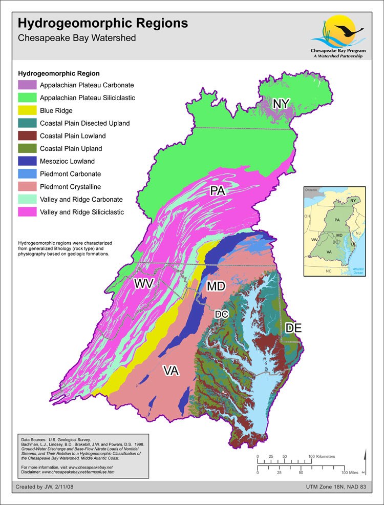
This map depicts the 11 hydrogeomorphic regions within the Chesapeake Bay watershed, as determined by generalized lithology (rock type) and physiography (based on geologic formations). These hydrogeomorphic regions, or HGMRs, have been used to assess the significance of groundwater discharge as a source of nitrate load to non-tidal streams in the Chesapeake Bay watershed (Bachman and others, 1998). This work is part of the U.S. Geological Survey's (USGS) efforts to develop an understanding and provide scientific information for the restoration of the Chesapeake Bay and its watershed.